Mud Spotter was developed in partnership with Queen Mary University of London and its application has been further supported by CaSTCo.
Mud or Fine Sediment entering river systems is a natural process that promotes the development and turnover of physical habitats. However, delivery of excessive quantities of mud, usually as a result of human actions, can lead to serious problems for aquatic ecosystems by smothering and clogging coarser sediments, depleting the oxygen supply for aquatic organisms, and often binding with toxic or undesirable substances. Widespread concerns about the deterioration in ecological condition linked to large quantities of fine sediments or mud entering sensitive rivers and streams have highlighted this as a physical pressure in many water environments together and a major gap in knowledge about mud sources and pathways.
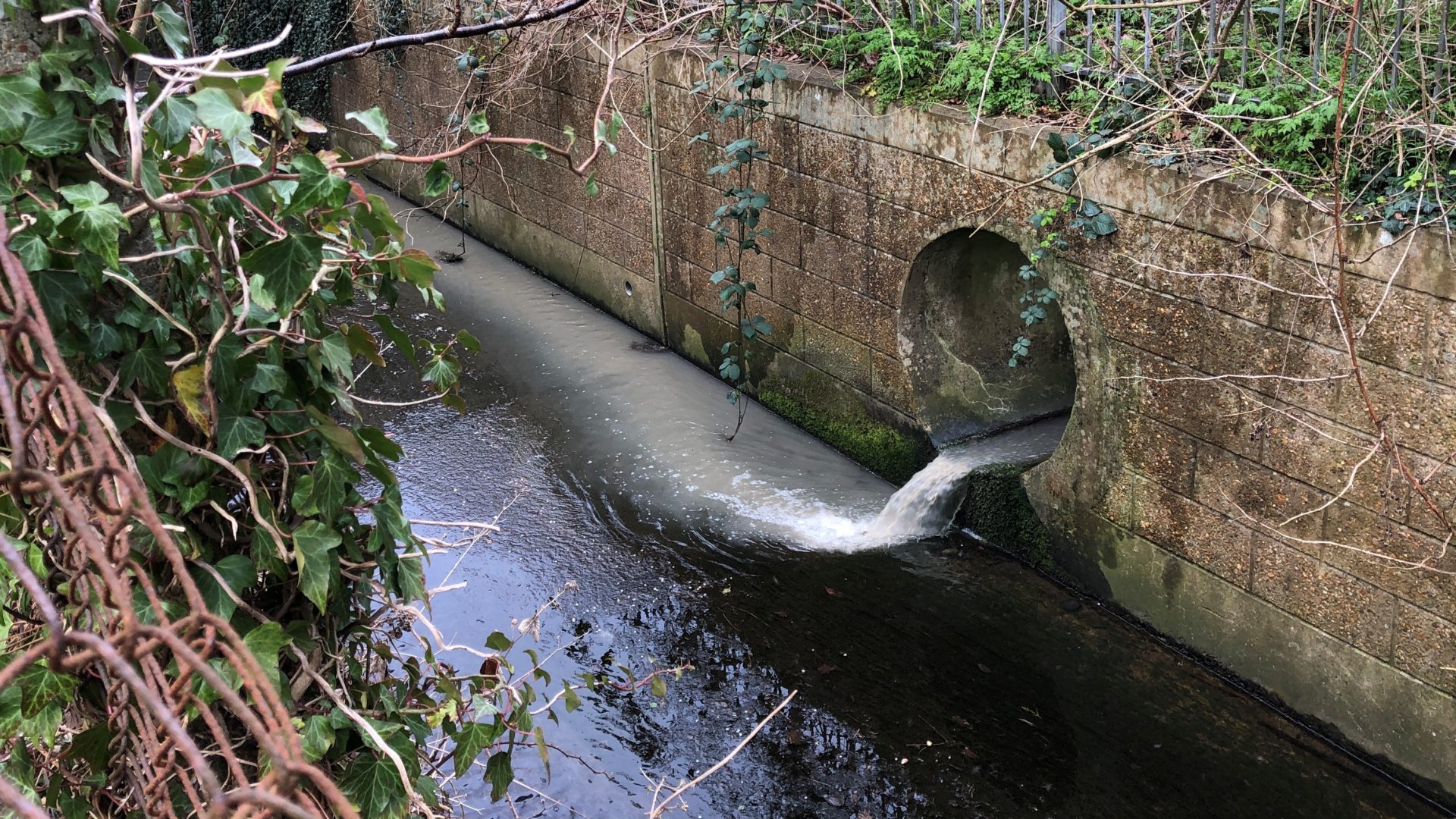
The Mud Spotter survey complements other water quality recording activities. It provides a simple tool for groups of volunteer citizen scientists and professionals to record the sources and pathways of mud being transported into rivers during or shortly after rainfall. Mud Spotter allows the rapid recording of water and mud inputs from individual mud sources such as culverts, pipes, ditches, overland flow pathways and eroding river banks. It allows inputs from these mud sources to be monitored as they respond to rainfall events and to be mapped along individual reaches of river. In this way, Data captured for each water-mud source includes its location; type and size; and the amount of water and concentration of mud being delivered into the river at the time of survey. Essential images and additional notes can be included in all records.
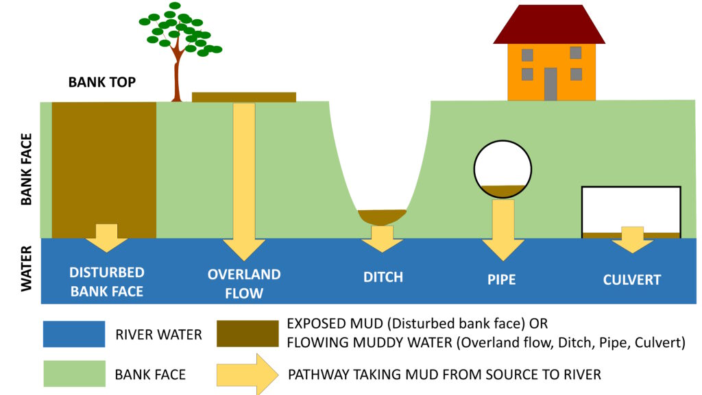
Mud Spotter allows the rapid recording of water and mud inputs from individual mud sources such as culverts, pipes, ditches, overland flow pathways and eroding river banks. It allows inputs from these mud sources to be monitored as they respond to rainfall events and to be mapped along individual reaches of river. In this way, Data captured for each water-mud source includes its location; type and size; and the amount of water and concentration of mud being delivered into the river at the time of survey. Essential images and additional notes can be included in all records.
For a demonstration of about how local river groups are using Mud Spotter to support their Water Quality investigations and evidence building, check out the River Chess Smarter Water Catchment Mud Spotter pilot.
You can find out more about recording mud sources using the Mud Spotter field survey by downloading the Mud Spotter Manual and the Field Survey Sheet (which we recommend using as a laminated reference alongside of the app). Please click on the blue button links below:
Following a short basic training, all Mud Spotter surveyors will have access to the knowledge and tools needed to begin recording their data. Most importantly – trained Mud Spotter surveyors will be able to record and upload their data quickly and easily to the Mud Spotter citizen science database via the Cartographer app.mud spotter: survey description & guidance (2025)

If you would like more information or access to Mud Spotter tools and basic training, simply click on the blue button below, we would love to hear from you:
Terms and Conditions
Modular River Survey training courses, including Citizen Science courses, are run by Cartographer Studios under their Training Terms.