MoRPh Estuaries was developed in partnership with Queen Mary University of London, the Environment Agency, The Rivers Trust, Wyre Rivers Trust, Thames21, Institute of Fisheries Management, and National Trust.
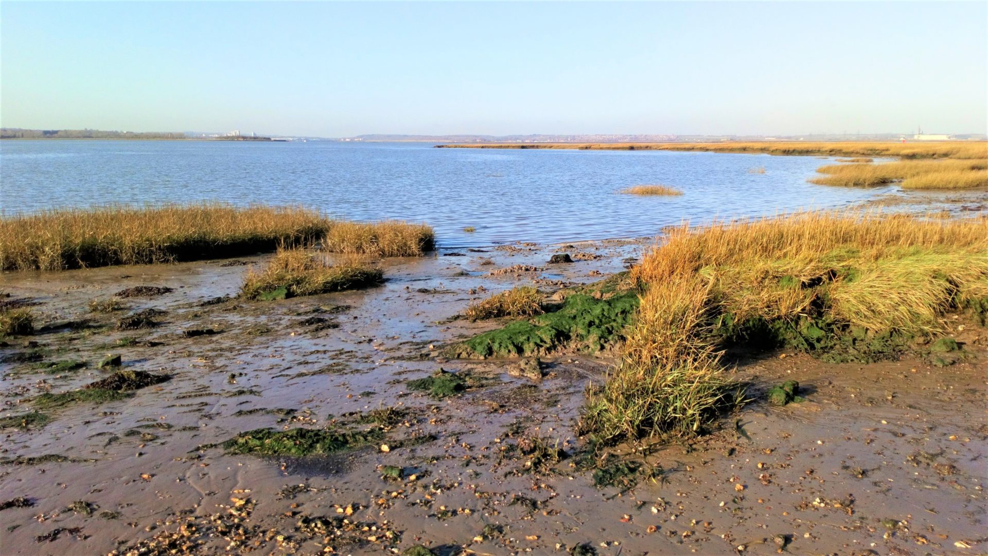
MoRPh Estuaries records details of the physical habitat characteristics along estuary margins for the tidal reaches of rivers. Field surveys capture information on sediments, physical habitats, vegetation structure, and human pressures and interventions for lengths of the estuary margins called modules. For each module the survey extends across the sub-, intra-, and supra-tidal zones of the estuary margins. Surveys must be undertaken within two hours of low tide to ensure all features are captured and ideally within two days of a Spring Tide. The survey supports the monitoring and appraisal of habitat conditions, for example, in relation to restoration and mitigation activities.
Tools
Assessments can be undertaken using surveys of individual or multiple modules.
Individual MoRPh modules
Individual MoRPh surveys can be used to record the physical habitat and features along a single module at a biological sampling site. When a single MoRPh survey is uploaded into the MoRPh database numerical indicators are extracted and can be mapped, graphed, and downloaded along with the raw data. Maps of individual indicators illustrate changes in the physical character of rivers along the estuary margin whereas graphs for a single location illustrate changes through time.
MoRPh5 surveys
A sequence of 5 adjacent (joined) MoRPh surveys provides a more comprehensive record of habitat characteristics along an estuary margin. When a MoRPh5 survey is uploaded into the MoRPh database, a set of integrative indicators are computed and can be mapped.
The module lengths for the individual MoRPh and MoRPh5 surveys are scaled to the MoRPh Estuary width. When conducting MoRPh5 surveys select the same module length for all the surveys. For upper and middle estuaries wider than 30m the module length is 50m. If both estuary margins are visible the left-hand and right-hand estuary margins can be surveyed. For estuaries wider than 100m only one margin is surveyed unless both are accessible.
History
The MoRPh Estuaries survey was developed in response to the widely recognised need for an appropriate habitat assessment tool for estuaries. It complements the MoRPh Rivers survey and enables a consistent approach to habitat assessment and monitoring to be applied through catchments from non-tidal through to the tidal / estuarine reaches.
Funding from the Environment Agency through the Championing Coastal Coordination (3Cs) programme facilitated a partnership approach (Queen Mary University of London, Cartographer, Wyre River Trust, Thames21, The Rivers Trust, National Trust, and Institute of Fisheries Management) to the development of the Citizen Science version of the tool (MoRPh Estuaries CSci). The pilot study (2021-22) comprised trialling of the field survey and the co-creation of the MoRPh Estuaries Storymap and the Wyre River Trust is actively using the survey for monitoring at several locations.
A professional version of the survey (MoRPh Estuaries Pro) is in development to complement the River Condition Assessment and is being trialled by several environmental consultants. Please get in contact if you are interested in finding out more.
We welcome interested parties to get in contact to work with us to trial the survey, both the Citizen Science and Professional versions. Simply follow the link below.
Modular River Survey training courses, including Citizen Science courses, are run by Cartographer Studios under their Training Terms.